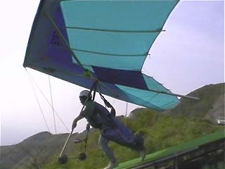
 離陸の瞬間 Take off |
|
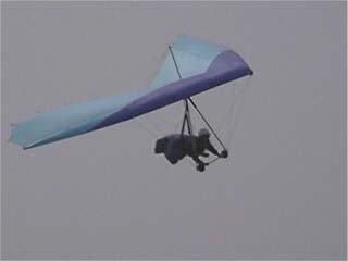 着陸のアプローチ中 Approaching for landing |
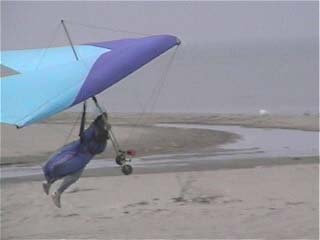 着陸の瞬間。フレア(引き起こし)をかけて空力でブレーキをかけます Just touch down. using flare(aerodynamic brake) |
飛行中の写真はVictor DV-1(小さいデジタルビデオ)をアップライトとキングポストにマウントしてとりました。
pictures were taken by me,
using JVC `pocket` digital video cam which is mounted to control bar of the hang glider.
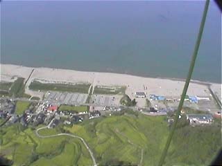
弥彦国立公園は佐渡を眺めることのできる新潟にあります。
Yahiko national park is located on east Japan.
離陸の瞬間 Take off |
|
着陸のアプローチ中 Approaching for landing |
着陸の瞬間。フレア(引き起こし)をかけて空力でブレーキをかけます Just touch down. using flare(aerodynamic brake) |
弥彦の海岸線がみえます。
you can see a beach line of Yahiko.
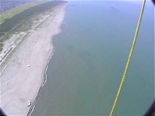
海の上を飛ぶのは気持ちがよいものですが、高度感覚がなくなります。
Flying over the sea is very nice!
However, we sometimes lost altitude sense over the sea.
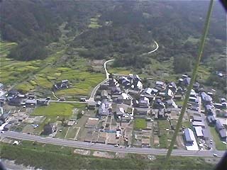
高度は約200mくらいでそろそろ着陸の準備を始めます。
The altitude is now 600 feet away from the ground.
So I have to prepare for the landing.
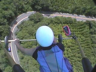
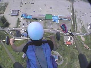
弥彦山の上を飛んでいます。
ハングはこのようにバーの下を持って操縦します。
ピンクのものは飛行計器で高度計、速度計、バリオ(昇降計-飛行機でいうVSI)が主なものです。
グライダーではバリオが一番大事な計器です。
Flying over the hills of Yahiko.
You can see that I am controlling the glider using triangular control bar.
Pink edged thing is flight instruments which contains speed meter, altitude meter and VSI.
The VSI is most important instrument for the glider.
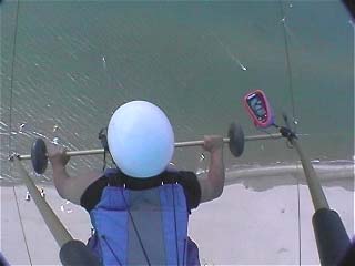
高度は350mくらいでスピードは30km/hくらいです。
わたしのタイプで最高速度は60-70kmくらいで競技用になると100kmを超えるものもあります。
The altitude is now 1000 feet , speed is about 20mile/h.
Top speed of my hang glider is 40mph to 45mph, competition glider can accelerate beyond
60-70mph!
下でウインドサーフィンしているのが見えます。
ヘルメットの脇にある黒いものは無線のマウントです。
それに加えてパイロットは緊急用パラシュートを胸の下につけます。
You can see wind-surfing below.
Black thing just left side of the helmet is a wireless communicator.
beside of it, We always equip emergency parachute under the bless.